






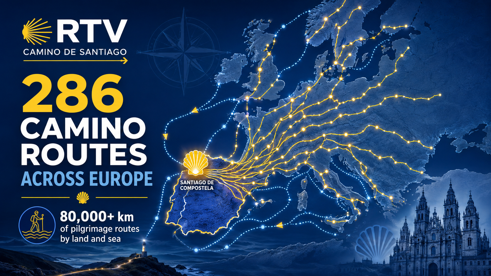
The Camino de Santiago is much bigger than the Camino Francés.
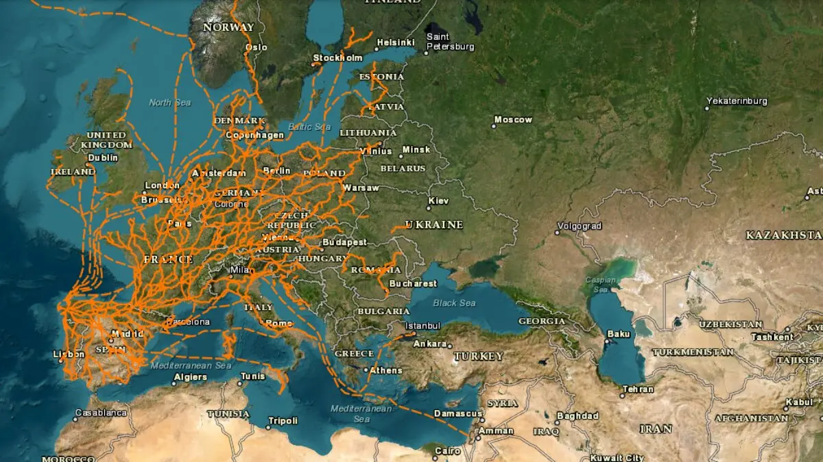
An official interactive map developed within Spain’s National Geographic Institute (IGN) and National Geographic Information Centre (CNIG) allows pilgrims to explore the extraordinary network of Camino de Santiago routes that stretches across Europe.
The scale is impressive.
The original European project brought together 286 Camino routes, covering around 80,843 kilometres, together with 31 historic maritime pilgrimage routes and information from 28 European countries.
Instead of seeing the Camino as a single trail beginning somewhere in France or Spain, the map reveals something very different:
a vast European network slowly converging towards Santiago de Compostela.
The Camino begins much farther away than many pilgrims imagine
Open the map and zoom out.
Routes appear across Germany, Italy, Switzerland, Austria, Belgium, Ireland, the Netherlands, Scandinavia, Eastern Europe and many other parts of the continent.
Some eventually connect with France.
Others continue through Spain.
But all share the same historic destination: Santiago de Compostela.
The Spanish Federation of Associations of Friends of the Camino de Santiago worked with IGN and CNIG, together with European Camino organisations, to build this continental cartographic network.
The project began taking shape in 2017, before becoming available as an interactive digital visualiser in 2018.
80,000 kilometres of Camino
One of the most surprising figures is the sheer length of the network.
The first major European database included approximately 80,843 kilometres of land routes.
That is enough to completely change the way many people think about the Camino de Santiago.
The famous final 100 kilometres into Santiago are only the smallest visible part of a pilgrimage network extending across an entire continent.
The routes shown are not simply random hiking trails.
According to the organisations involved in the project, they correspond to documented and signposted Camino routes, many of which are maintained by Camino associations and supported by infrastructure for pilgrims.
You can download the routes to your phone or GPS
The map is not only interesting to look at.
It can also be genuinely useful when planning a Camino.
The CNIG makes Camino geographical data available in formats including GPX, KML and SHP, allowing routes to be used in compatible navigation applications, GPS devices and mapping software.
For pilgrims planning lesser-known routes, this is particularly valuable.
Instead of relying only on a static map, users can explore individual sections, download tracks and study how different Caminos connect with one another.
The map is still being updated
Although the visualiser has existed for several years, the Camino network shown on it is not frozen in time.
The CNIG continues to introduce corrections and updates as new route information is received.
The most recent specific update cited by the project was made on 8 June 2026, affecting routes including the Camino Francés, Andalusian Caminos, island routes and Caminos in north-eastern Spain.
Other northern routes had also been revised earlier in the year.
That makes the tool much more than a historical curiosity.
It is a living cartographic project.
The Camino also travelled by sea
Perhaps the most fascinating part of the map is found not on land, but on the water.
The European Camino project also documents 31 maritime pilgrimage routes.
For centuries, pilgrims from places such as Britain, Ireland and northern Europe travelled by ship before continuing towards Santiago on foot.
Those routes formed part of the same pilgrimage system that created the Camino Inglés and other historic approaches to Galicia.
The maritime network even demonstrates just how international pilgrimage to Compostela became long before modern tourism existed.
A different way to understand the Camino
Most first-time pilgrims discover the Camino through a handful of famous names:
Camino Francés.
Camino Portugués.
Camino del Norte.
Camino Primitivo.
But the European map makes those routes look like branches of something much larger.
A pilgrim can theoretically begin hundreds or even thousands of kilometres away and follow a succession of historic Camino routes towards Galicia.
Germany connects with France.
France connects with Spain.
Italy, Switzerland, Belgium, the Netherlands and many other countries contain their own networks.
Eventually, the yellow arrows all point in the same direction.
286 routes, one destination
Perhaps that is the most beautiful thing about the visualiser.
It turns a familiar phrase into something almost literal:
all roads lead to Santiago.
Not one Camino.
Not ten.
Hundreds of routes crossing borders, languages and landscapes before converging on a small city in Galicia.
For anyone planning their next pilgrimage, the map also creates a dangerous problem:
once you see how many Caminos exist…
choosing only one becomes much harder.